Well, since I
majored in Environmental Biology at the University
of Montana way back when, I was always walking
around wherever I was stationed and looking at the
flora and fauna, trying to figure out how it all
fit together in that particular ecosystem.
Diego was an especially interesting place, because
it was surrounded by an untouched reef of fabulous
diversity, while the environment on the island
itself was completely artificial - that is altered
by human habitation beyond all recognition of its
pre-human state. A lot of the information I
have about the island came from the Atoll Research
Bulletin No. 149, August 27, 1971 from the
Smithsonian Institution, Washington DC, titled
“Geography and Ecology of Diego Garcia Atoll,
Chagos Archipelago” edited by D.R. Stoddart and
J.D. Taylor, and form "Ecology of the Chagos
Archipelago" edited by Charles R.C. Sheppard and
Mark R.D. Seaward.
As for
animal life, the island is composed of coral
rubble and sands laid down since the last Ice Age
(about 12,000 years ago - the period since then is
called the Holocene). Beneath that, about 60
feet below sea level, there is limestone which was
the island during the last Ice Age (called the
Pleistocene, which lasted about 2 million
years). Because of the sand & gravel
nature of the Holocene deposits, fossil evidence
of terrestrial fauna is entirely lacking.
However, it's possible that the islands are very
young - according to Stoddart in 1971, the
surfaces did not peek above sea level until 2,000
to 5,000 years ago (the Holocene began when the
ice sheets melted which caused the sudden 60 foot
rise in sea level - it took corals thousands of
years to grow up to the new sea level). A
couple thousand years isn't generally considered
enough time for endemic species to evolve.
However, it is estimated that during the last ice
age, the Chagos comprised some 13,000 square
kilometers of land, for at least 200,000
years. What we see today is a sandy island
perched on the very top of the mountain that
previously existed. Because of it's
isolation, there may even be remnant populations
of animals evolved during the Pleistocene.
Let's face it, the Chagos archipelago, including
Diego Garcia, was never very heavily populated,
and it's possible something still remains for you
to discover!
The
island was uninhabited when discovered by the
Portuguese explorers in the 1500's, and remained
so until the French arrived in the 1790's to
establish coconut plantations. Of course, as
was the custom in those days, the French
themselves did not do the work on the plantations,
but imported slaves, primarily from Madagascar and
their colonies of Mauritius and Reunion (the
latter two were, like Diego, uninhabited when
discovered by the European explorers - and home to
the famous, but soon extinct, Dodo birds).
Based on linguistic remnants, it appears most of
the slaves ancestors originated in what is today
Mozambique. At any given time, about 500 -
1,000 people lived on Diego Garcia during the
"Plantation Era" from 1786 - 1971.
Above left - Calophyllum
inophyllum (Takamaka tree).
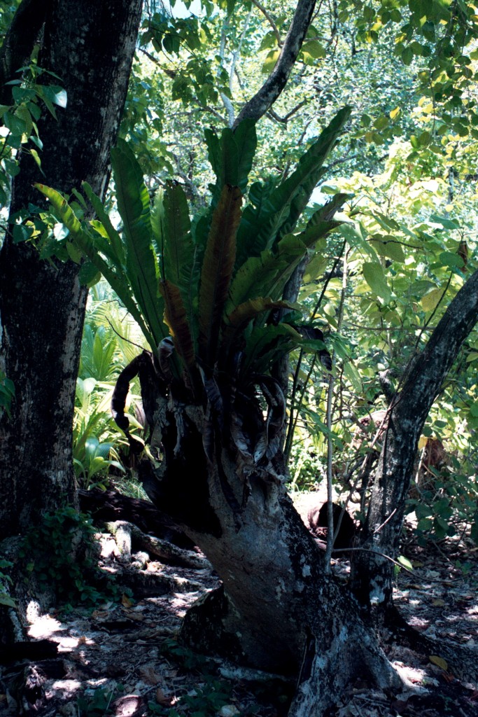
Above right - a bryophyte
growing out of an old stump.
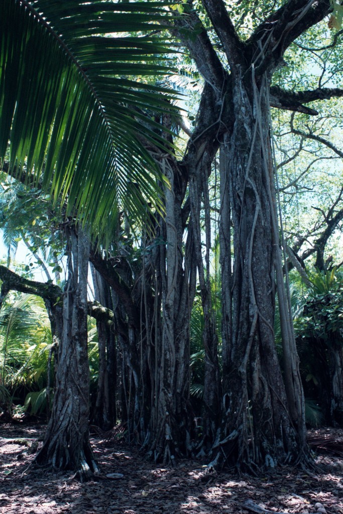
Below left - Ficus
benghalensis, commonly called the Banyan Tree.
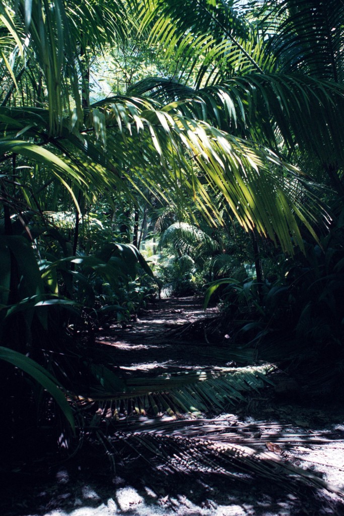
Below right - A path through
young coconut trees (Cocos nucifera).
The invasive coconut can be legitimately called a
"weed" on Diego Garcia!
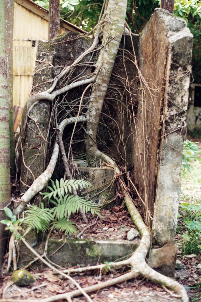
Below: A Banyan Tree takes over the
outdoor latrine at the East Point Plantation Manor
House. This plantation was abandoned in 1971,
and this photo was taken in 1987. The "jungle"
works fast!
Originally,
Diego was covered by hardwood forests. Some
remnants remain at Point Marianne, Mini-Mini, and
around the plantation area. According to the
ARB #149, all the rest of the broadleaf hardwoods
were turned into lumber and shipped back to
Madagascar and Mauritius by the first French
"settlers" in the process of clearing the island for
the plantations. In their place, various
plants in addition to coconuts were imported by the
French and later the British. The most common
was what everyone called "Scaviola" (Scaevola
taccada) bush, which is a broad-leafed succulent
growing to about 20 feet tall on DG, mostly along
the shore - as seen in the composite photo of the
entrance to Barachois La Paille Sec, which we called
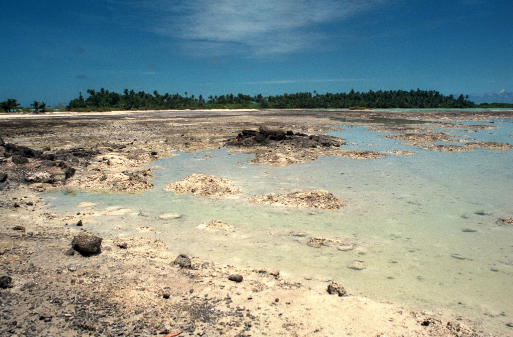
"Shark Cove" below.
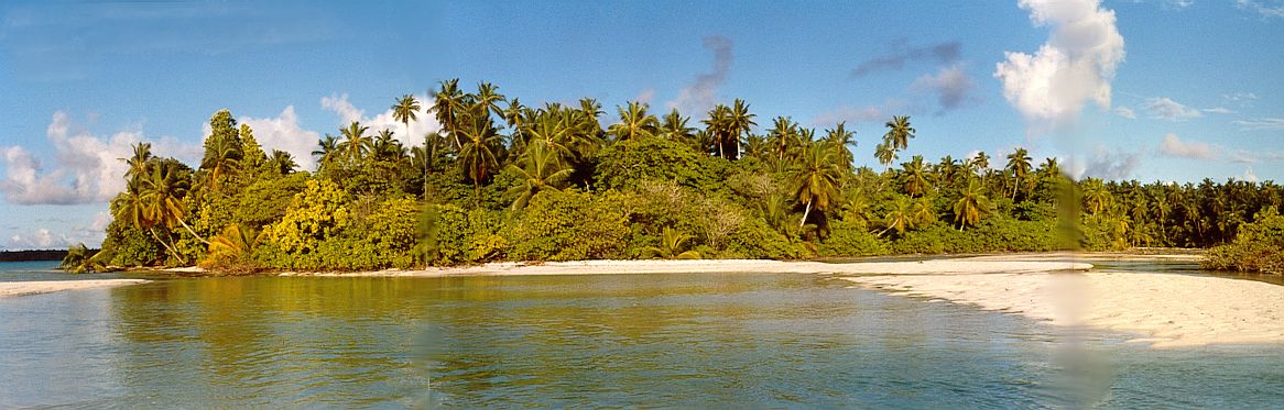
The Entrance to "Sharks
Cove" (a.k.a. Barachois La Paille Sec - which
means "dry straw")
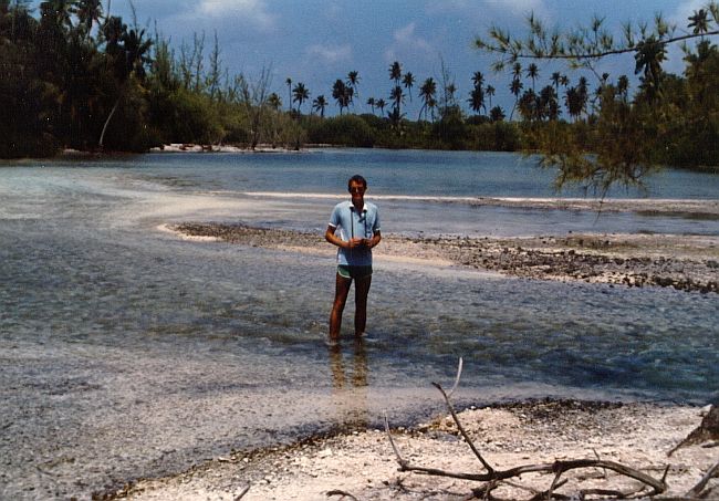
My buddy Steve Swayne at one
of the entrances to Barrachois Maurice, near the
East Point Plantation; 1982.
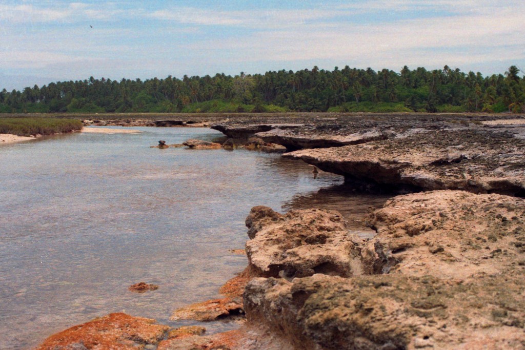
Above: The
interior of Barachois La Paille Sec with the
tide almost out. The sea grasses you see
on the left dry out between tides and probably
resulted in the name of the barachois.
Below: Barachois Barrer (the central
barachois of "Turtle Cove") at low tide.
One
of the most interesting features of the island were
the "barachois" which has no direct translation, but
most people convert it to "cove". For example,
the three intersecting Barachois of Sylvain, Barrer,
and Courpat are now collectively called Turtle
Cove. In the photos above, Steve is
standing in the mouth of Barachois Maurice, which is
about half way between GEODSS and the
Plantation. These barachois are lagoons off
the main lagoon, and there are several on the
southeastern leg of the island, from the south tip
around to the northeast to the area of the
Plantation (Barachois Lubine). These barachois
were generally dry at low tide, and filled with the
high tide. As tides on DG only ran about 3
feet, these barachois were regularly bathed in
shallow water twice a day. The tide ran
swiftly through the gaps, and it was always
interesting to watch schools of minnows, small fish,
sharks, and turtles come in and leave with the
tide. I assume they were going in to eat
(minnows eaten by small fish, which are eaten by
small sharks, etc., ad nauseum), and you could
clearly watch the Hawksbill turtles chowing down on
algae which covered the coral ledges. However,
these barachois should not be confused with
estuaries or salt marshes. They were sea water
fed and drained, period.
There is fresh water on the surface of Diego Garcia,
but it doesn't "flow" anywhere. Fresh water
marshes around the East Point Plantation were
reported by surveys in the 1960s. There is a
large freshwater marsh just NW of the USAF ("SAC")
ramp on the airfield. This apparently was a
low spot on the island that when framed by the
taxiway, parking apron and road, filled with rain
water. It was filled with aquatic weeds when I
was there in 1988, and is reported to be the home of
Bufo marina toads today. There are several
unstudied and virtually unknown fresh water ponds on
the southeastern arm of the atoll, running
parallel to the ocean-side beach, west of the road,
from the southern edge of the Bomb Dump south past
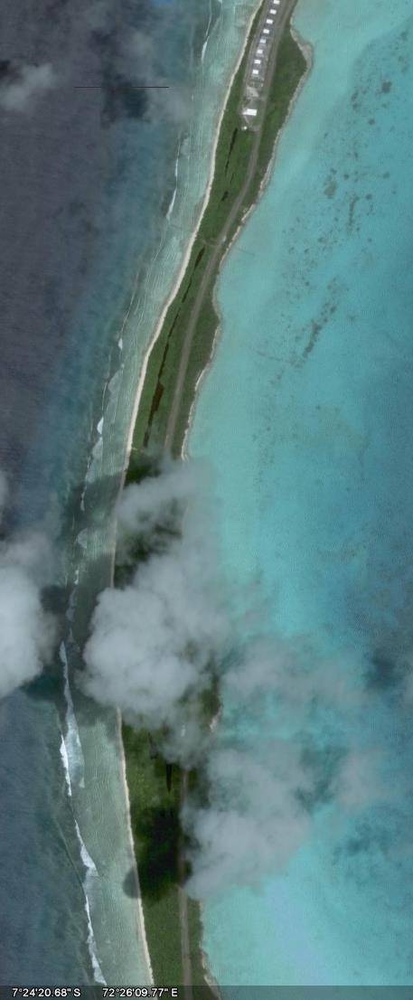
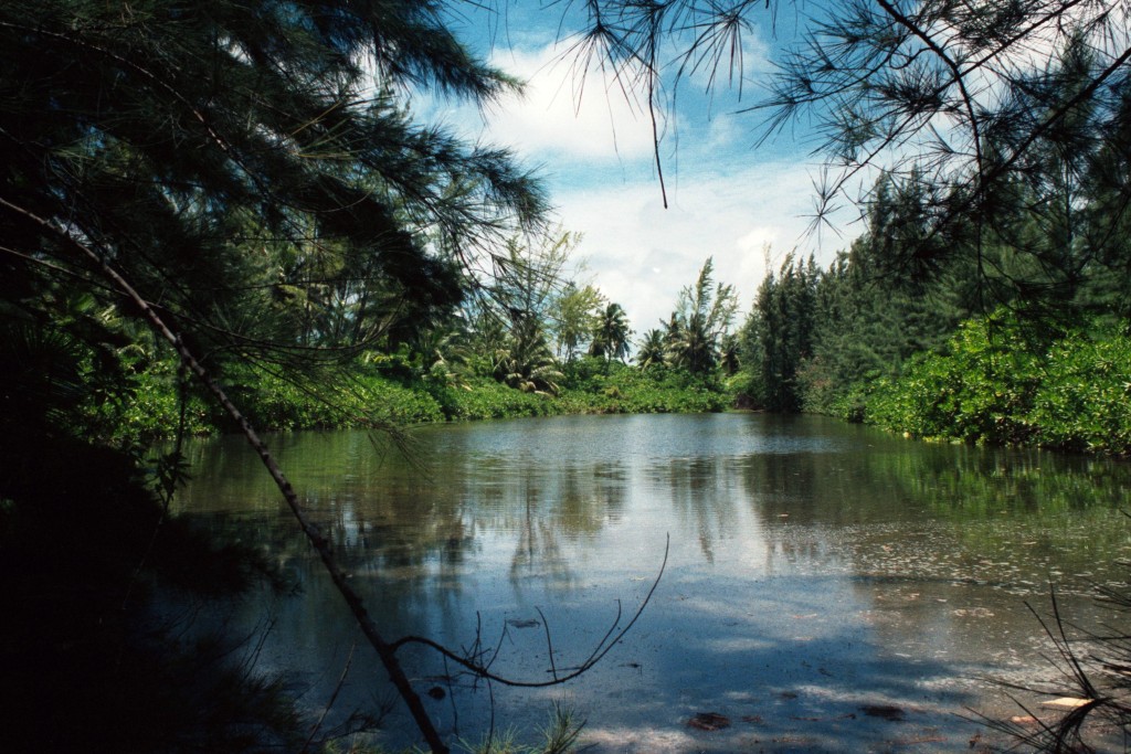
the Donkey Gate and on for about 1.25 miles.
They can be clearly seen on "Google Earth" (as seen
below). There is no information that I can
find about the origin of these ponds - whether they
are natural fissures or "borrow pits" to build the
road. At any rate, when I took the picture of
one of these ponds in 1988 (also seen below), there
was nothing living in them that I could see other
than algae, although there were hundreds of
dragonflies in the air above them. Hopefully,
someone has stocked them with bluegill and bass by
now, they would make great fishing ponds.
The
Brits kept a very close watch on the environmental
health of the island, and the east arm is kind of
a wilderness area, and visitation by base
personnel is limited and controlled. Most of
the lagoon is a designated RAMSAR (wetlands)
preserve. In 1988, there were three horses
over on the east side, as well as donkeys. I
did see two of the horses, which were quite wild
by that time, over by the Plantation in
1988. I was told one was a gelding (those
damned British Veterinarians must have caught the
poor fellow) and the others a mare and a filly
(never to become a mare with only a gelding
around), so unless a stallion swam down from
India, or snuck ashore off the Mary Jane, the
horse population is extinct out there now, too.
I know
elsewhere in this monologue, I've bad-mouthed the
Brits a little. However, the one thing I
think they did pretty well was ensure the island
was protected ecologically. Basically they
did this in two ways: By making the USN keep
the industrial pollutants contained and remove
them from the island, and by making it a crime,
punishable by the Magistrate of the island (the
Brit Rep himself), for individuals to molest just
about anything but insects (or each other, or, for
most of us, ourselves). For example, a
permit was needed to travel to the east arm of the
atoll, or to build a fire so that people wouldn't
burn down the protective hedges along the
coasts. Once, I watched some BIOT police
arrest a young sailor for pissing on a palm tree
outside the Acey-Duecy Club (though whether it was
for molesting the palm tree, or public indecency,
I don't know). Most especially, it was
absolutely illegal to kill Coconut Crabs, Sea
Turtles, and Spiny Lobsters.
The
Brits attempted to control the predators on the
island, to protect the sea birds and Coconut
Crabs. In 1971 and 72, the Governor of the
Seychelles, who was also the Commissioner of the
BIOT, had the SEABEES kill all a reported 800 dogs
left by the Ilois when they were expelled from the
island. Some say they were shot, others that
they were rounded up and gassed with exhaust from
trucks. They also killed all the pigs (I
hope the pigs didn't die in vain, and at least
provided a luau or two) leaving only rats and
cats. The Brits were always trying to kill
rats, and made every attempt to control the cat
population by rounding them up every once in a
while, putting them in wire cages, and throwing
them into the lagoon to drown.
Unfortunately, they were always catching the "dorm
cats" which were basically pets fed and loved by
the Americans, which caused a lot of hard feelings
by the Americans. It was reported that by
2006 there were only 3 cats left alive on the
island. Also, they then figured they had to
control the chickens, since the cats weren't
around to eat the chicks, and when the chicken
population got out of control (because the cats
had been drowned), the Brits would let the
Filipinos catch them and eat them.
The
Brits also tried to pay attention to the "TCN"
(third country nationals - the Filipinos and
Mauritian workers) on the island. Though
paid a very good wage, compared to what they would
receive at home, these people brought their 3rd
world concepts of nature with them.
Basically, this meant if they could catch it, they
would eat it, and if it meant saving 50 cents for
a meal they wouldn't have to pay for in their mess
hall, then all the better. At least as late
as the 1980s they were always "poaching," and
although no body cared if it was chickens, they
also did not distinguish between sea turtle eggs
and chicken eggs. The classic example of
what they were capable of was that the northwest
end of the atoll was devoid of crabs and chickens,
except in the American dormitory area, where the
GIs and Sailors protected the cats and
chickens. South of the airfield was
generally not visited by the TCNs, and there, the
ecology, artificial though it was, was preserved
from their appetites. Unfortunately,
this may be a preview of what is to come for
Diego. Unless there is an awakening of
environmental responsibility on the part of the
government of Mauritius when the island is
eventually turned over to them, there is a good
chance it will become, literally, a desert island.
INVASIVE
SPECIES
A word
now about "invasive species". This is one of
the hot topics in the environmental world.
Basically, it means a species not originally
native to an area that has been introduced, either
on purpose or accidentally, by man's
activities. The problem with invasive
species is that they sometimes compete with native
species for resources and can alter the natural
balance. Sometimes it leads to extinction of
native species, either the competitor species or
the prey species. Modern examples are the
Brown Tree Snake eating all the native birds on
Guam and Salt Cedars displacing the Red Willow in
the Rio Grande basin. But after a while,
nature balances itself out again, although
extinction is sometimes the price. So,
generally, introduction of new species is
considered a bad thing.
Unfortunately,
sometimes it is too late to stop the invasive
species, as things have already balanced
out. For example, on Diego Garcia, the
terrestrial environment of DG is nothing like what
it was before the arrival of humans.
Basically, the island was clear-cut of its native
forest and replanted with coconut trees.
Over the next 150 years or so, all the terrestrial
land birds were brought in (dove, fodys, mynahs,
chickens, etc.) as were the rhinoceros beetles,
earthworms, ants, toads, geckos, donkeys, cats,
rats, horses, dogs (extinct since 1971),
etc. Also the scaevola was introduced as was
the ironwood (pine-type trees) and any flowering
trees and flowers you see out there. These
invasive species have now formed a biome in which
they co-exist in relative balance. The
problem seems to be that the "native" species,
such as coconut crabs, warrior crabs, sea turtles,
and nesting sea birds have been impacted by SOME
of these invasives, most notably the rat.
The coconut palm grows as a weed everywhere, and
the dense jungle created by young trees
effectively keeps the native hardwoods from
getting re-established.
The UN
has an agreement that says that the host nation
(in this case the Brits) has an obligation to
eliminate ALL invasive species, and some people
want exactly that to happen. Why? What
is wrong with the geckos and donkeys and chickens
and earthworms? Why would we cut down the
Plumeria Trees and all the Ironwood? To
"restore" the native balance would basically
require a scorched earth policy - take the island
down to coral sand and start all over.
And what was the pre-human ecology of the
island? No one knows for sure! So why
worry about it? There is NO GOOD REASON!
It is
absurd to even contemplate the UN's rules.
Do we want to bring back huge colonies of seabirds
and keep sea turtle eggs from being dug up and
eaten? Sure. So eliminate the cats and
rats, and the seabirds and sea turtles will
prosper, and that is a noble goal. Cut down
the coconuts and replant hardwoods. Great
idea. But to go on and on and on as some do
about eliminating all invasives, and using recent
introductions like the toads and agana lizards to
bash the Brits and the Americans is pure
politics.
DG will
NEVER be what it was, and there is no good reason
to try and make it so.
HUMAN USE
AND INDUSTRIAL WASTE
The real
challenge has been the industrial wastes of the
Island, and the Brits at least took their
responsibilities rather seriously - and required
the U.S. to play along. The potential for
pollution on the island came mainly from sewage
from human waste, bulk metals, and POL (petroleum,
oils and lubricants). The USN has a very
comprehensive plan for keeping the environment as
pristine as possible, but let's be honest, unless
the 'host nation' insists on conservation
management, the US Military won't - it's not part
of their mandate. So the Brits are to be
praised for saving Diego Garcia.
The "recyclable storage" area
north of Seabreeze Village in 1987 - now it's the
Golf Course.
There
is a huge sewage plant on the central part of the
northwest point of the island, and another near the
airfield, both easily visible in aerial
photos. The sewage is treated in a tertiary
plant - which is the best there is technically -
with the last step disinfecting. Outfall is
down a pipe into the depths of the ocean.
Scientific expeditions in the 1990s and early 2000s
report that the outfall is deep enough and diluted
enough that the pollutant levels in the surrounding
waters is "virtually pristine".
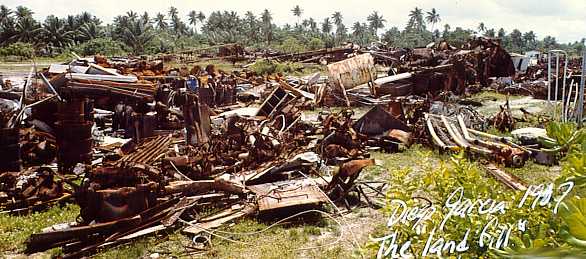
There
was at one time a huge dump just north of the
airfield, but in the 1980s the monthly supply
ship, the Mary Jane, took away a ship load of that
metal trash to Subic Bay for recycling on each
visit, and most of it was gone by 1988. It
is now the island's 7-hole golf course and as can
be seen on the golfing page on this website, the
place shows no evidence of its former use.
The Navy still stores up metal and ships it off
the island on ocassion. Typically, the US
ships the metal to the U.S., but beginning in 2006
began selling it to recyclers. For example
in 2006, Big Iron Trading Company made 3 trips to
DG to salvage 10,000,000 pounds! of scrap
metal in their ship the MV IRON BUTTERFLY,
and paid $115,000 to salvage the stuff. I
guess recycling pays, but only $23 per ton.
There
was also a landfill for biodegradable trash
located about 2 miles south of the airfield, near
I-Site South. Again, scientific expeditions
have found no trace of pollution from that site
into the lagoon or freshwater lenses.
The fuel
situation was the most challenging, since it
involved the freshwater lenses. On tropical
"desert" islands like DG, fresh water is found
just a few feet below the surface, even though
there are no springs or streams anywhere.
What happens is that the rains (DG had an average
of over 100 inches of rain a year) would seep into
the sandy surface and displace or push out the
salt water that would normally seep into the
aquifer from the ocean and lagoon sides. The
freshwater would settle into a convex "lens" just
below the surface. There are several of
these lenses on DG, and the freshwater for the
island was extracted from them by an ingenious,
computer controlled, complex well field. The
deepest wells are only 15 feet deep, and computers
monitor the water pressure in the lenses, to
ensure not too much water was extracted from any
one lens, which would allow the salt water to
intrude, and the process of rebuilding the lens
begun again. Rebuilding a lens could take
years - flushing of the huge "Cantonment" Lens on
DG would take 4 - 5 years, while the smaller
lenses along the narrow portion of the islands
would flush in just a year or two. There are
about 125 wells from the airfield north.
Ever wonder where the water comes from on
DG? Here's a diagram showing the three
developed lenses (the airfield lenses are not
currently in use as of 2008):
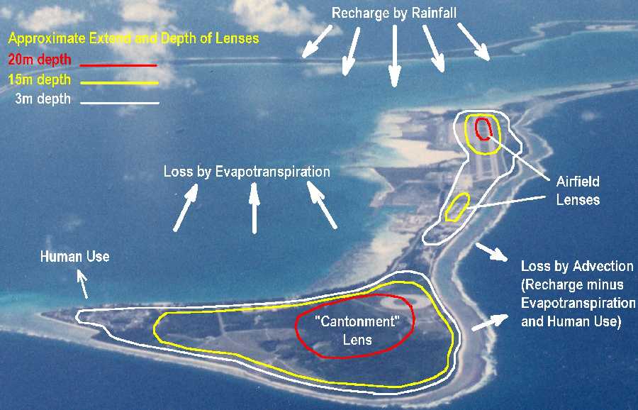
Approximate
extent and depth of the Cantonment and
Airfield fresh-water lenses on Northwest Diego
Garcia. The base uses over 100
shallow “horizontal” wells to produce over
150,000 gallons per day from the “Cantonment”
lens. It is estimated that this 900 acre
lens, which is about 70 feet deep at it's
deepest, holds 5 billion gallons of
fresh water and has an average daily recharge
from rainfall of over 2.5 million gallons, of
which 40% enters the lens. The other 60%
is lost through evaporation and transpiration
from trees - a coconut palm will transpire
about 50 gallons a day!
There are also
small lenses tapped for water at T-Site and
GEODSS.
The airfield wells were drilled after
the construction of the new runway, aprons, and
fuel pits in the early 1980's.
Unfortunately, there were some leaks in the fuel
system, and, as usual on military airfields in the
1970's and early 80's, all sort of solvents,
cleansers, etc., were just hosed off the aircraft
and the aprons into the nearest ditch. There
was a huge amount of fuel stored on the island,
with underground lines leading from the POL pier
near Pt. Marianne to the fuel storage areas and
pits near the SAC ramp, and north of the
airfield. A lot of fuel leaked out into the
freshwater lens at the airfield. As I recall
being told at the time that, there was an
estimated one million gallons of JP-5 (which is
the military name for "Jet A" fuel, which in turn
is basically Diesel No. 2) in the lens, "floating"
(because of its lower specific gravity) on top of
tens of millions of gallons of fresh water, and
that it was extracted using the water wells in
place, and shipped back to the P.I. for
re-refining, although the POL man at the time (Mel
Wasikowski, now sadly deceased) told me that is
was useable just as it came out of the
ground. Although this would be a novel way
to store fuel for future use, it was not the
politically correct solution! So the fuel
was extracted, and I guess by now the airfield
lens has been restored.
Editor's Note 31
Mar 08: Apparently they didn't get it all
at first, or there were other leaks or
spills. From 1996 to 2003 the USAF
conducted "bioslurping" to recover approximately
40,000 gallons of jet fuel from the "SAC Ramp"
area. Read all about it - direct from the
EPA! Click
here and go to page 2 of the PDF for the
article "Large-Scale Bioslurping Operations
Used for Fuel Recovery".
POLITICAL
DRIVEL
Earth First and Greenpeace, you're out
of luck. As much as you might like to
"return" the island to its "natural" state, I
don't think it could be done. The existing
ecology is pretty well balanced, with the cats
eating the chickens and the rats, etc., and the
donkeys kept pretty much in check by salt bloat
(and thus dying young) and castrations.
Someone could rehabilitate the seabird population
if they could kill all the rats and cats from the
donkey fence on southward and up the east arm and
replace the fence with a dike - creating a kind of
wilderness area. They could cut down the
coconut trees and replant with broadleaf
woodland. Of course, that costs big bucks,
and will probably never be done. And of
course, nothing will bring back the extinct local
species that apparently lived there before old Don
Diego Garcia arrived. So, all you hard-core
environmentalists out there, you've got two
choices as I see it - 1) Educate the 3rd
world, and 2) Spend your money on restoration
projects, rather than chasing that Norwegian
whaling ship all over. What? You say
#1 isn't politically correct? And #2 is
first priority? All I've got to say is, if
dolphins are so smart, how come they keep getting
caught in those nets............(apologies to
Dennis Leary).
WHY TRYING
TO MANIPULATE THE ECOLOGICAL BALANCE SELDOM
WORKS
Cindy Qoth's
October 2000 Update - I was reading the Nature
pages, and you mentioned geckos. They are
all over the place now! I really don't
recall there being many, if at all before.
It is really kinda creepy making rounds in the
middle of the nite and walking some places in
BEQ 14, one or twospots with 20 or so of them on
the roof of the walkways and walls. The
make sort of a chirping croak...very
weird. At least they are cute.
The Cattle Egrets have taken the place of all
the chickens, and are all over. There is a
chicken cull every quarter, where only the
roosters are supposed to be taken. Of
course, the hens are, too, and it pissed off
alot of people to have bitty chicks left to fend
for themselves or get eaten by...things.
The frogs/toads whatever are all over the
place...there were more until the rat poison was
put out. The rats were everywhere, so
poison was put out. Then there were less
land crabs and frogs, the flys fed off the
rats, and on up/thru the food chain.
The crabs must be getting hit worst, they eat
the dead rats AND the dead frogs. To top
it all off, the chickens are getting inbred, with many more fluffy
chickens than I recall being around
before. Fluffy ones don't have grown up
feathers, more like downy feathers.
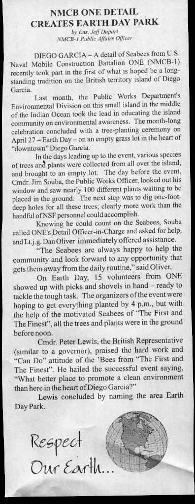
Mike Bodi's
Submittal: The SEABEES take part in the
EARTH DAY, 1972:
|