The PROPEOPDEMREPDG
Department of Aviation Extravaganzas Presents:
Aerial Photos of Diego
Garcia...
Get up off your beach
chair, climb in our special photo-recce plane, and enjoy
the view!
Show your wife and/or
husband and kids exactly what the durn place really looks
like!
Show them exactly where
you worked, fished, snorkeled, and passed out on the beach!

 |
|
O.K., here's the way this page is set up -
Got a photo of DG you'd like to share
with the World? Don't forget to go to Google Earth and
take a look too.
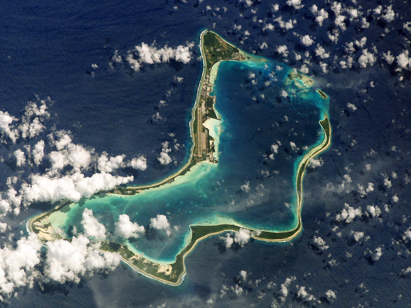
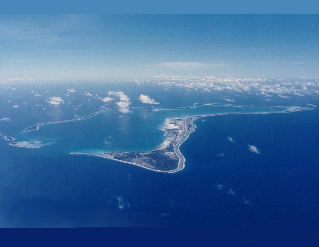
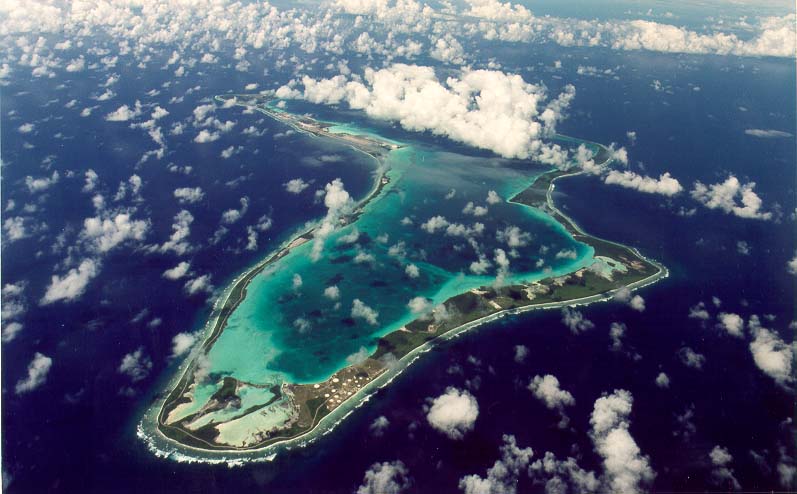
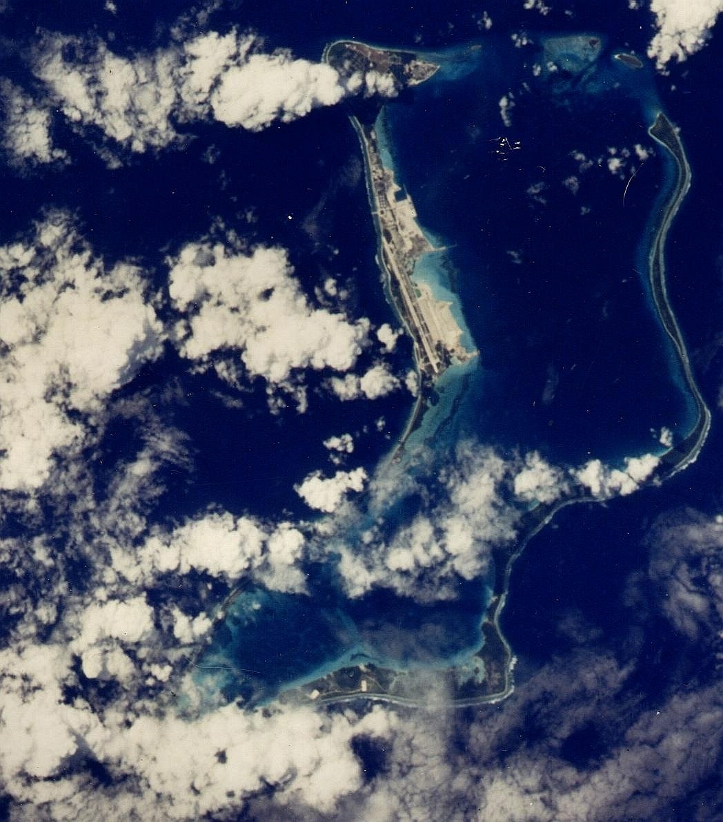
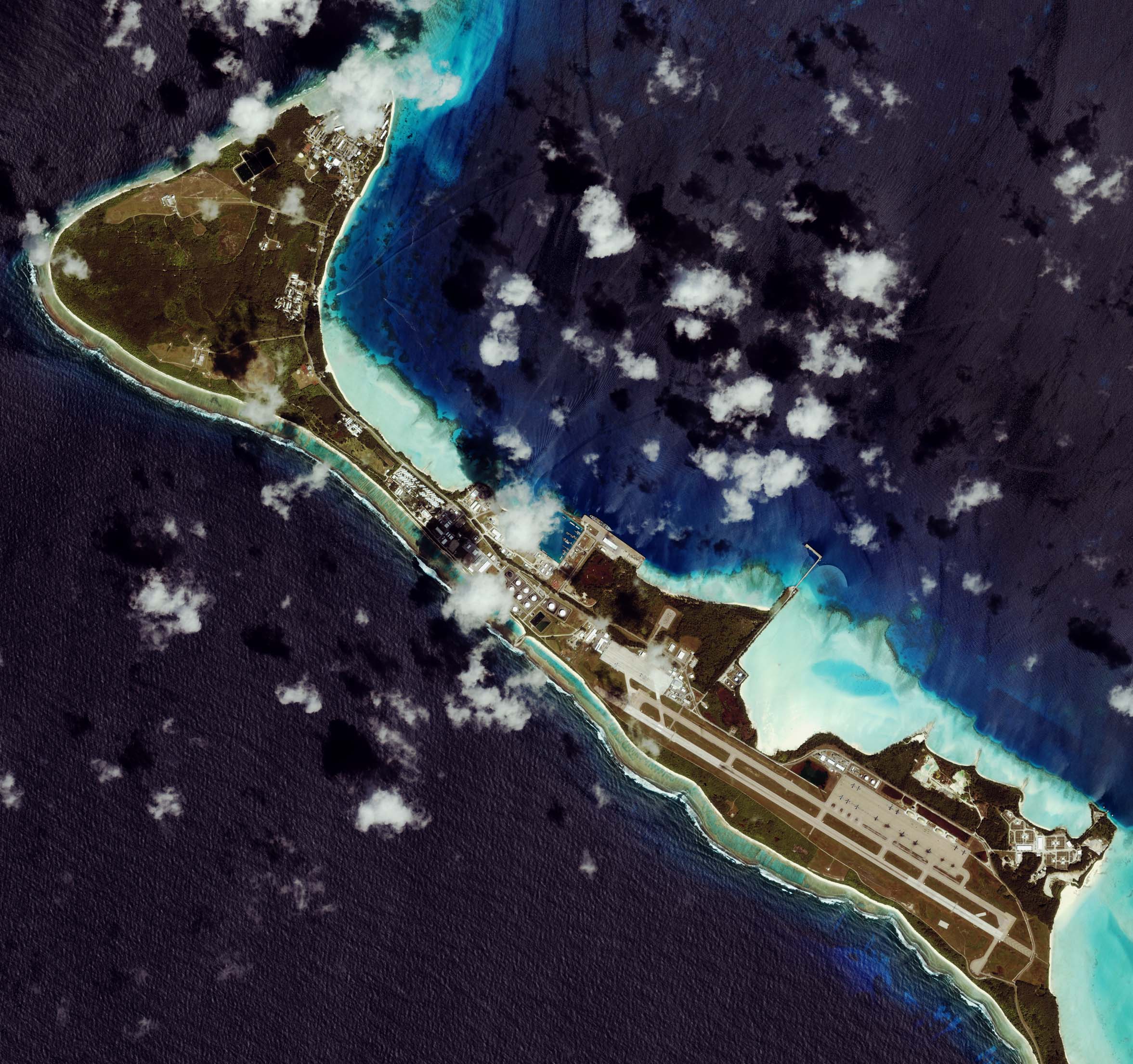
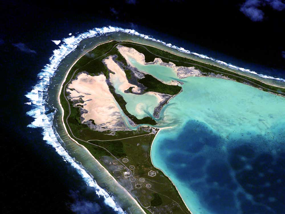
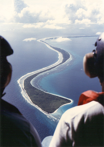
DIEGO GARCIA - The Whole Ball of Wax Here's a 2006 photo,
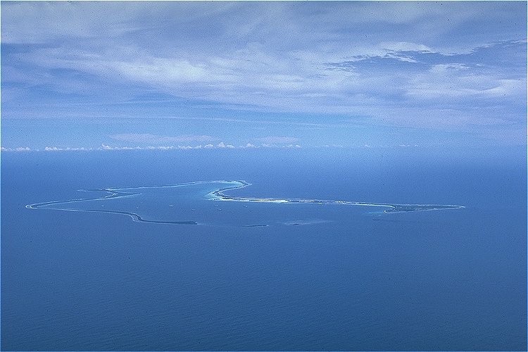
looking South: 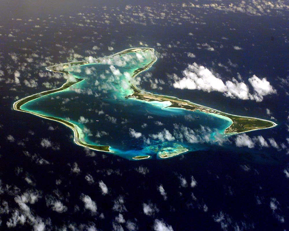 Here's one looking
North: 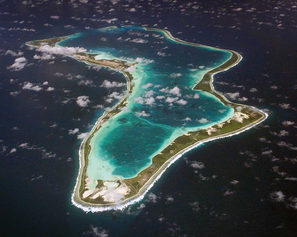 Here's a good oblique
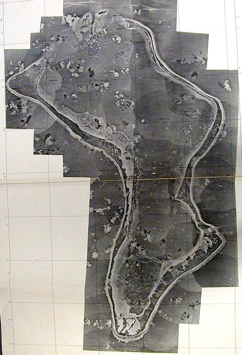
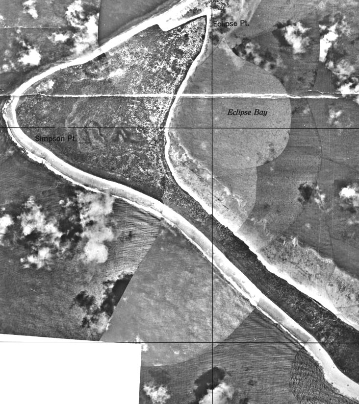
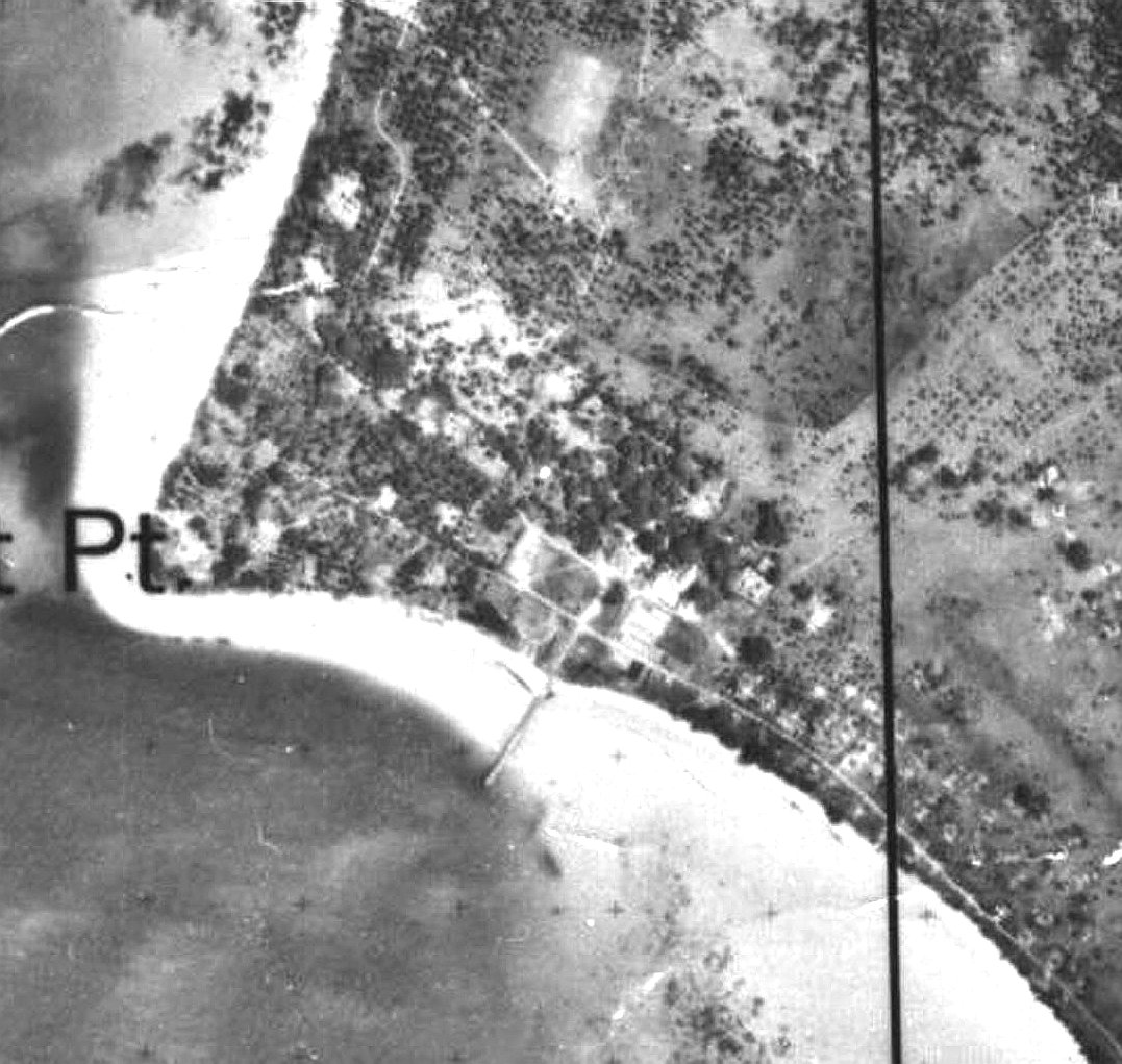
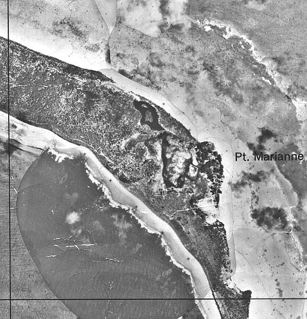
shot. Below: This is a controlled mosaic compiled by the Naval Reconnaissance and Technical Support Center from January 1965 Photography (pre-buildup). The island probably hadn't changed significantly since it was converted into coconut plantations in the 1700s. Many thanks to Kirby Crawford who writes: "The original measures 28" x 42", and is made up of a large number of aerial photos taken from an aircraft. This was one of the few pieces of information we had about DG before we sailed in for our 1968 - 70 program." The detail photos (down below - click on the thumbnail for a better version) are of Eclipse Point (now downtown), East Point (the Plantation), and Point Marianne (now the airfield and Camp Justice).
Click on these
thumbnails for bigger and better versions:
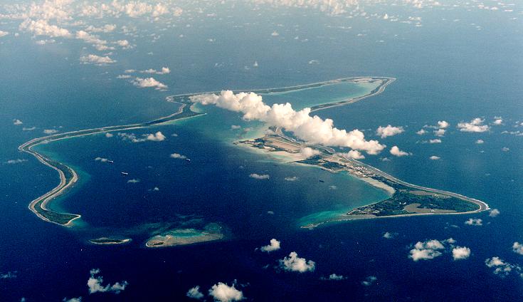
Left Above: Looking Southeast.
Left Above: Looking South.
Left
Above:
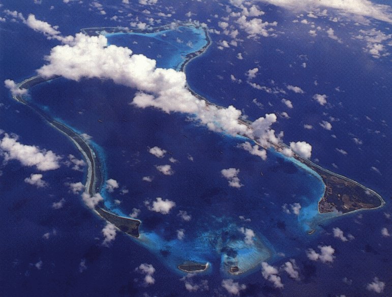
Another aerial from the Northeast. From "The
Friends of the Chagos" CD (with permission) Original
photo
by 'JETMAN' - "I would have shot it in late 1989
or early 1990 from an SH-2F at an altitude of
10,000 ft. It was about 50 degrees at
altitude. Used a Bronica for the negative
version. Also have it in Kodachrome 25 shot
with my Leica."
JETMAN also has a great sense of humor.
Read his "Tattler"
newsletters for Dodge from that period right
on this website!
Right Above: A shot from just about due
north.
Left Above: Looking Southwest.
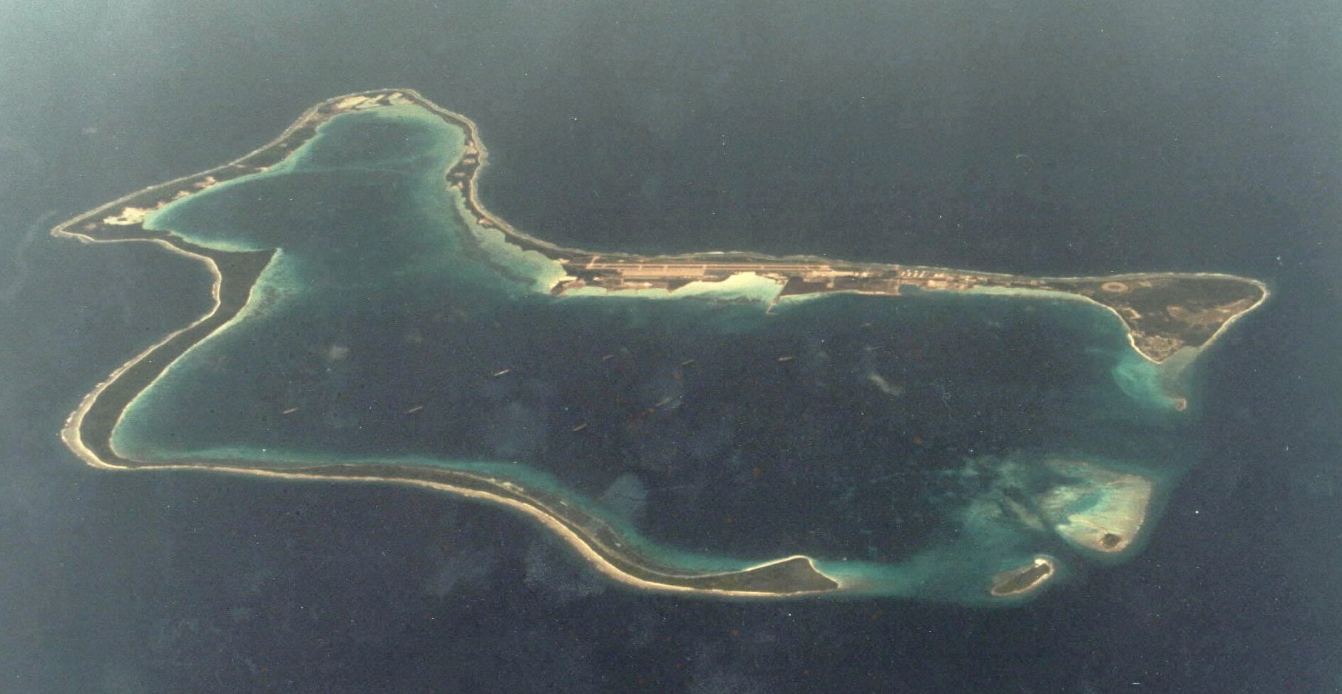
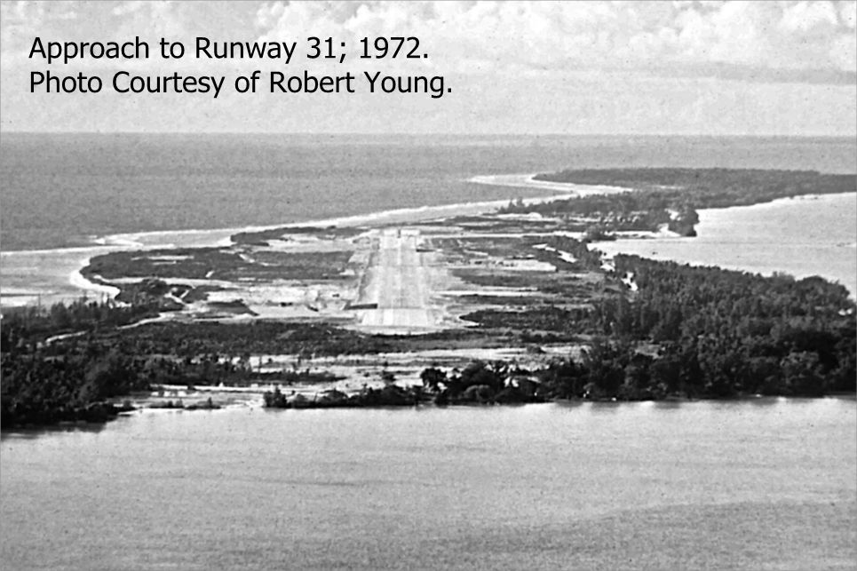
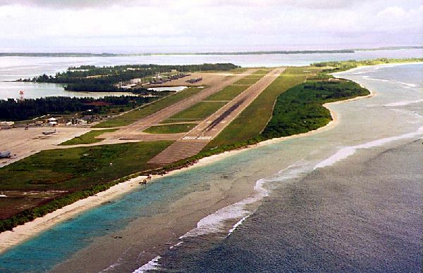
THE "AIRFIELD" IN 2005
THE AIRFIELD THEN - JULY 29,
1971 As
seen
from the first C-130 to arrive, which then
flew an "orientation" flight around the
island the next day. Many thanks to
Chaplain Larry Sellers for this photo.
Above: Diego Garcia Runway 31 in 1972 Below: Diego
Garcia Runway 13 in 1973
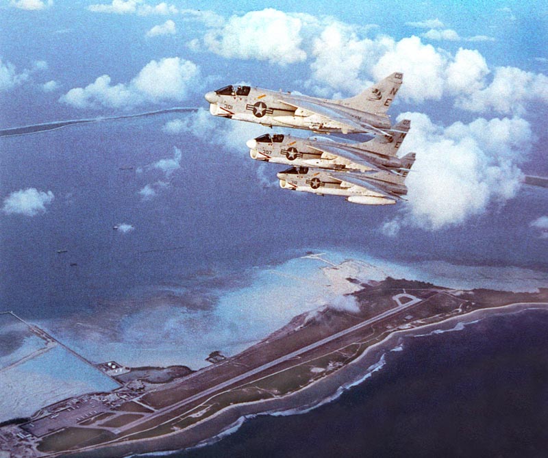
Above:
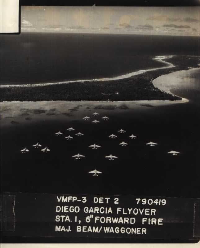
CAG
5 propaganda picture from April 1979. Shows
the original configuration of the airfield before
RBRM built the "Space Shuttle" runway in the early
1980s. They first built an interim runway
(now the taxiway) and then widened the old runway.
Below: A Postcard showing the current
runway configuration - taken during DESERT STORM.
Note the SAC Ramp in the far distance is full of
tankers and bombers.
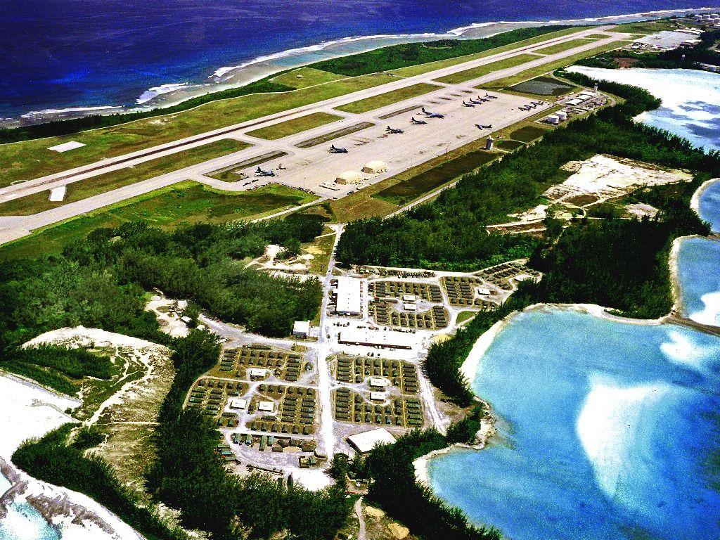
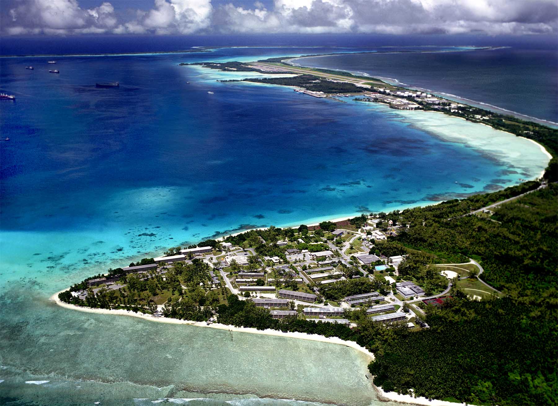
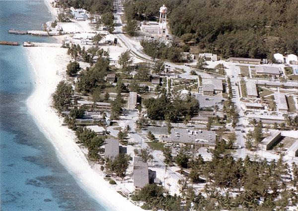
This is a photo of the main
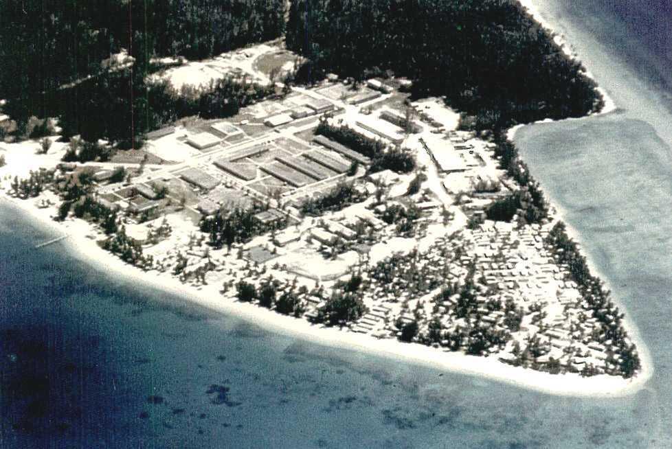
developed part of the island. DOWNTOWN 2006 Here's "Downtown" September
1973. From NMCB 74's "Beaver Tale" (via Vidge
Villanueva). The caption reads: "Take
one last look at your home for the past eight
months, and take a deep sign, because with any luck
at all, you'll never have to see it again. The
camp as shown in this picture will be torn down when
the Seabees leave for good in a few years. As
you can see, it was a beautiful place but easy to
leave." 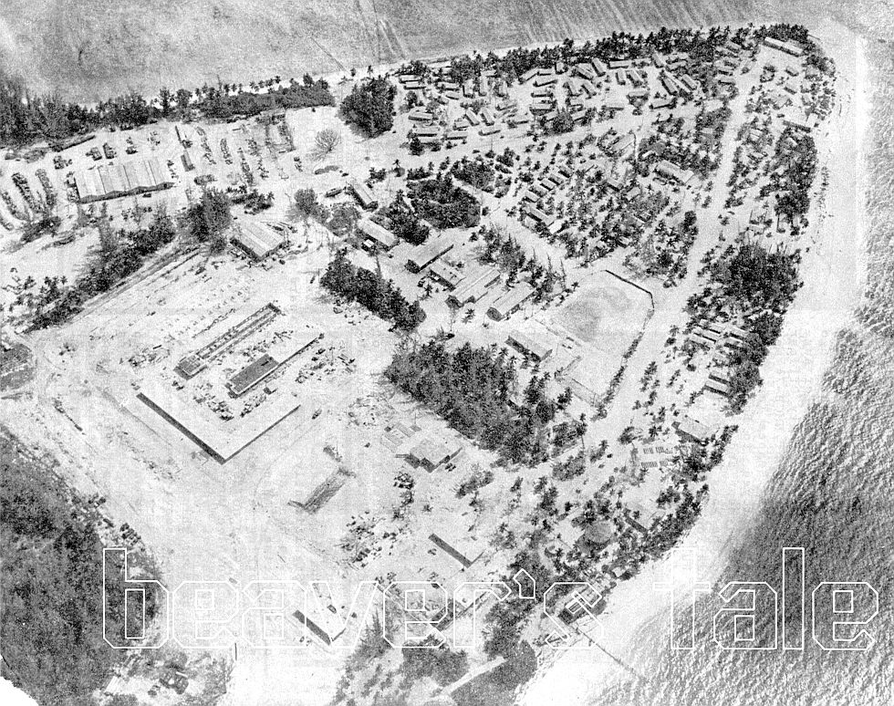 Here's a photo I downloaded off some site -
sorry for stealing it! Downtown, about 1979
Here's a couple of Cathy Hines' photos (these ones are of Downtown, 1984).
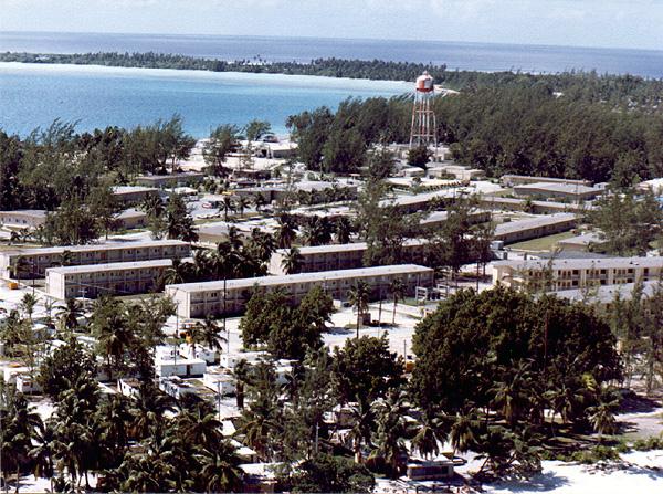
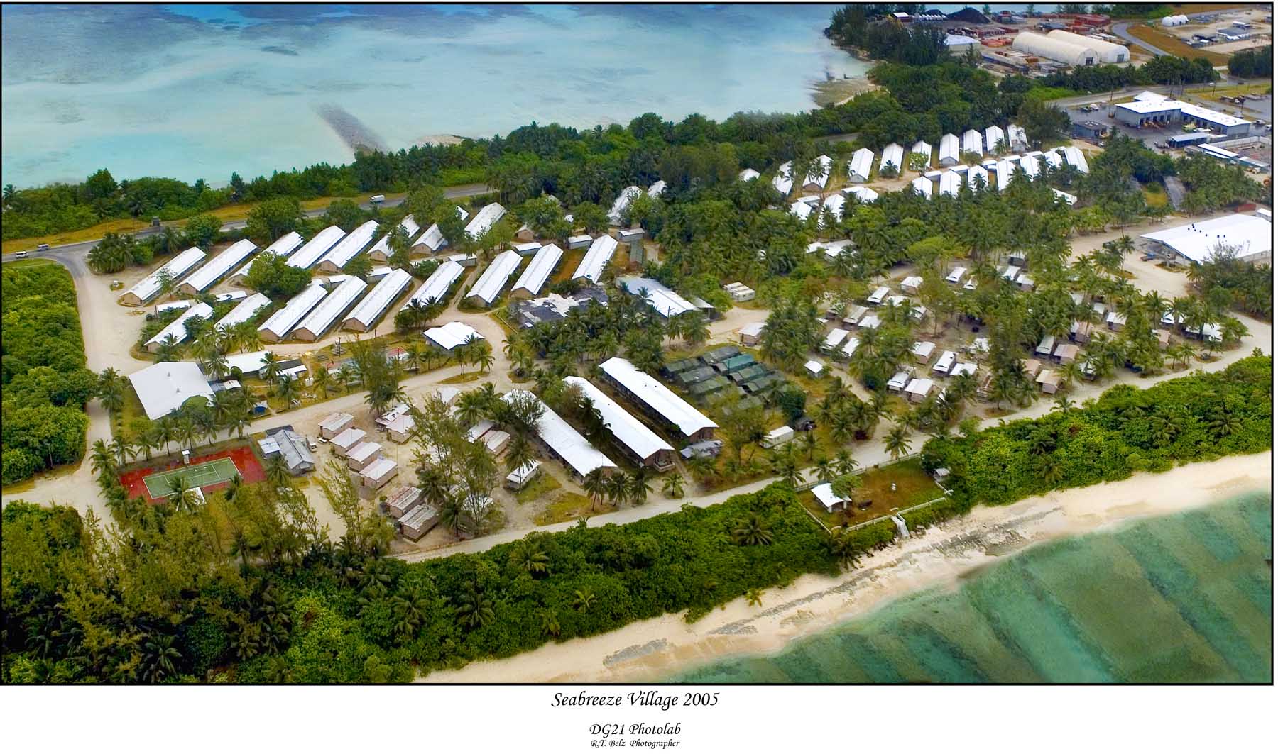
SEABREEZE VILLAGE 2006
Here are Carl Villanueva's pictures of the
plantation in 1972 (click on the thumbnail for the
full size photo): .
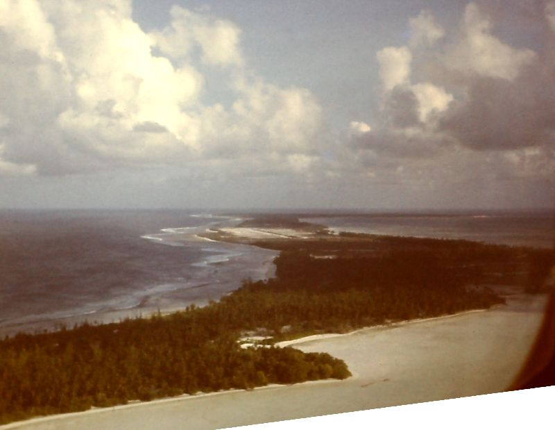
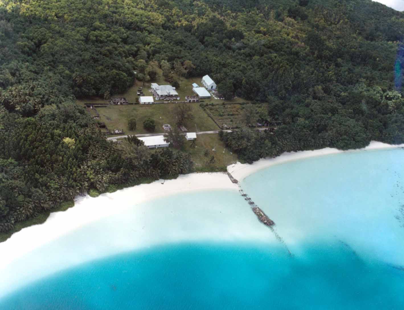
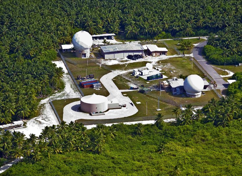
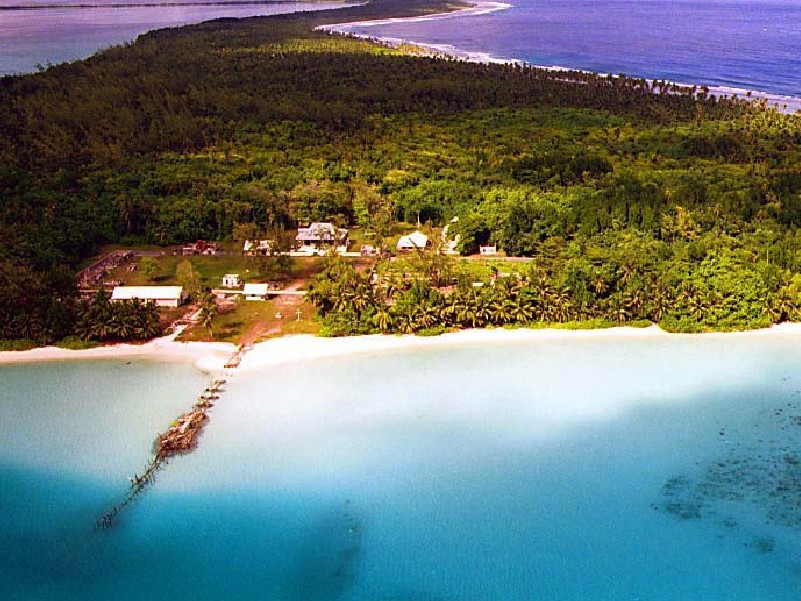
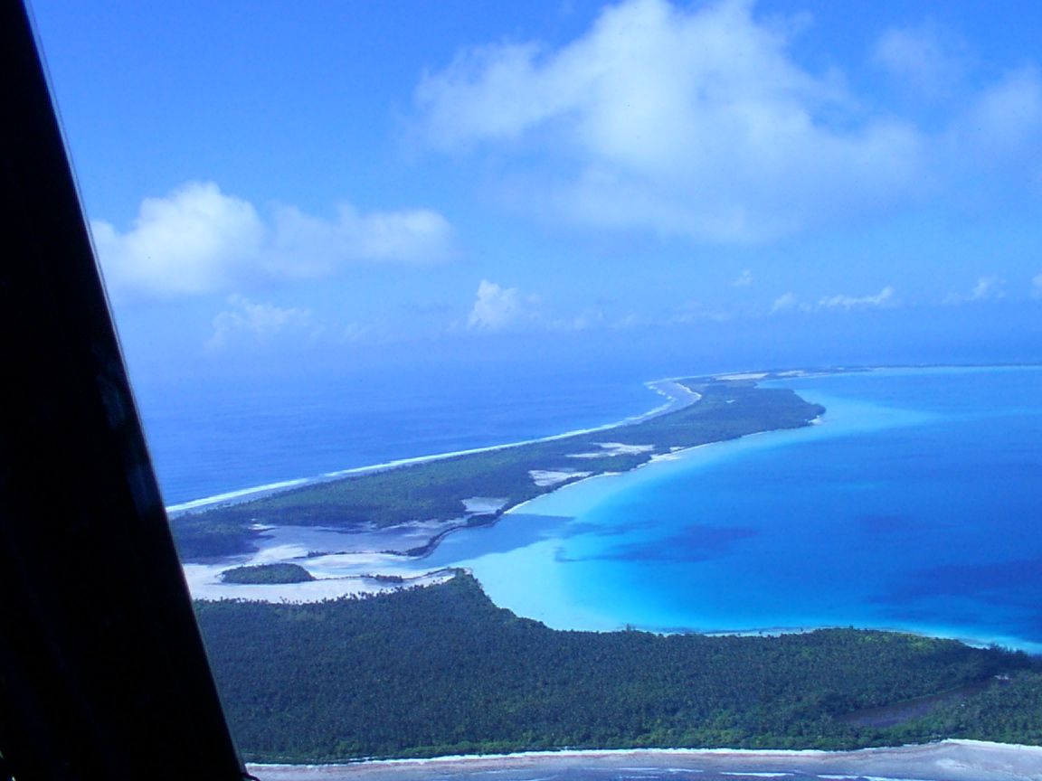
THE HINTERLANDS: Here's Turtle Cove and T-Site,
2006:
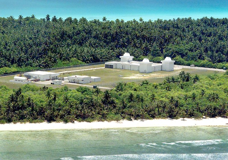
Here's a photo of the GEODSS Site at the South end:
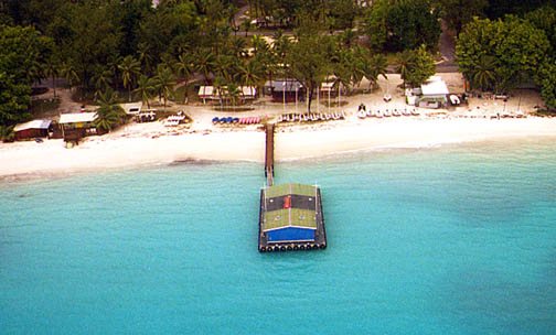
Thumbnails to click upon! Here are some shots that are now sold as postcards at the Ship's Store on the island (photos are probably from the early 90's):
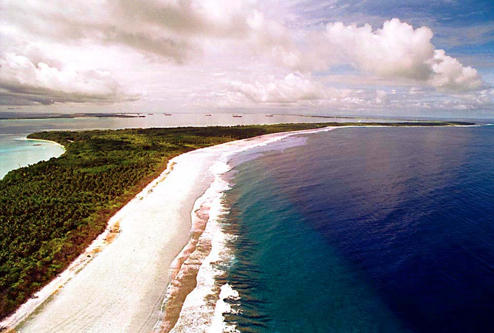
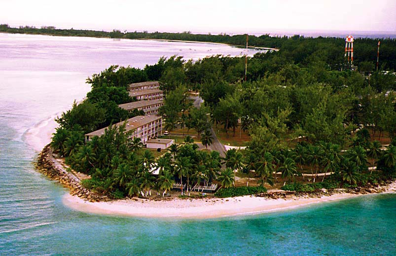
Above left is the southeast beach (the point of land on the left is the location of the Plantation), and above right, the Officer's Club (under the trees in the foreground).
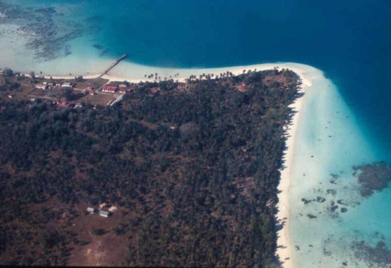
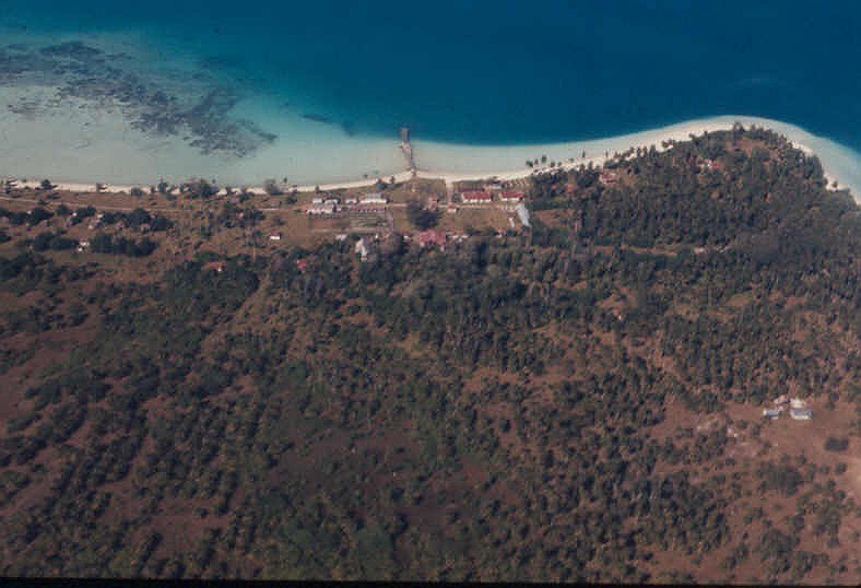
Left Above: The Plantation. From: "Asief" <afiefrahaman@cox.net> I
couldn't help but notice your website and thought
you might need some new pictures of Diego Garcia, I
just recently left there after being station there
with the USAF for 4 months so here are some new
pictures hope that sheads new light into your
memories. It is mainly a B-52, B-1, and
B-2 base now. I have more recent pictures let me
know if you are interested in seeing them.
 |
|
| Global Security page on pre- and
post-Tsunami Dodge: http://www.globalsecurity.org/military/facility/diego-garcia-imagery-3.htm
To see a satellite shot of DG after the Tsunami: http://www.spaceimaging.com/gallery/tsunami/default.htm#diegogarcia For a REALLY high resolution, sub-meter image of the airfield taken in March 2003, go to: http://www.imagesatintl.com/orderimagery/imagegallery/diego_garcia_high.jpg |